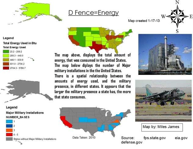
This is a map and visual aid made during the GIS college course. It represents the energy usage in the United States, compared with a map of the various major military installations, in the states.
|
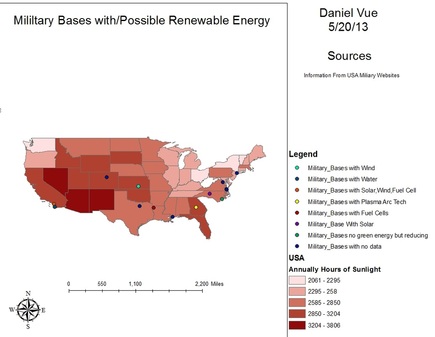
This map is a map with the locations of military bases with renewable resources. This map also has how many hours of sunlight each state has. This sunlight information can help DOD find locations for new military bases with solar energy.
|
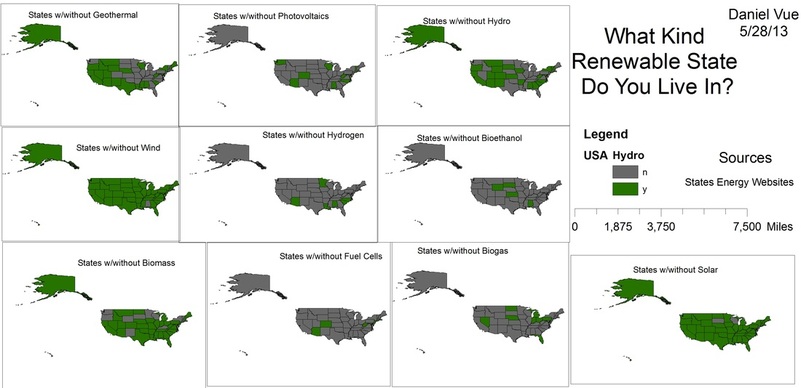
This is a map of the states with what kind of renewable resources that they use. This can help the military located new bases with renewable resources. For example if military wants a navy base they would put the base in a state with hydro power.
